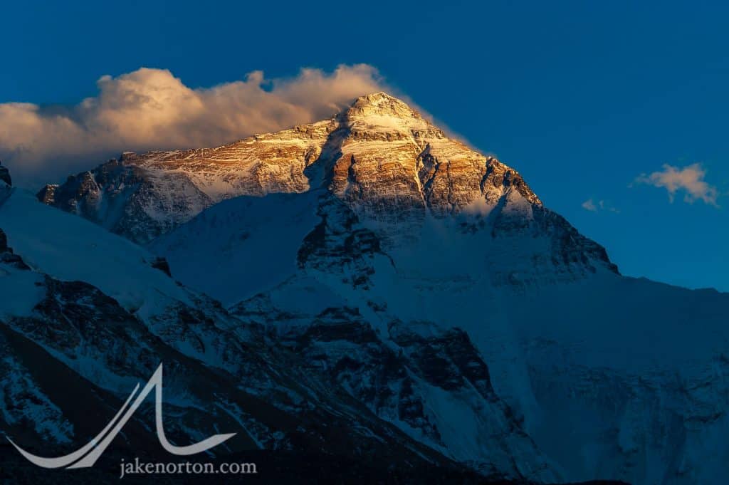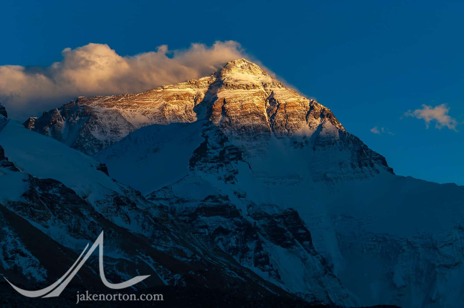
To reach a summit is very palpably to have triumphed over adversity: to have conquered something, albeit something utterly useless. It is the imagined significance of the summit – which is, after all, nothing but a patch of rock or snow raised higher than any other by the contingencies of geology; a set of co-ordinates in space; a figment of geometry; a point without a point – which has largely given rise to the industry of ascent.
- Robert Macfarlane, Mountains of the Mind: Adventures in Reaching the Summit
In 1852, a Bengali mathematician named Radhanath Sikdar made a startling computation: a peak - known unceremoniously as “Peak XV” on maps of the day - stood at 29,000 feet above sea level. If his calculations were correct, he had found the highest peak in the world, stealing the throne from Kangchenjunga, then thought to be the highest. (Kangchenjunga is now known as the 3rd highest peak.)
After much checking and re-checking, Sikdar’s boss Andrew Waugh, the Surveyor General of India, ratified his calculations and declared Peak XV to be the highest mountain on earth. (Interestingly, Waugh thought the round number of 29,000 feet would not be believed, and thus the official announcements pushed it up to 29,002 feet, leading to the joke that Waugh was the first to put two feet on the summit of Everest.) A conundrum quickly arose, as the peak needed a name, and as far as anyone could tell (or chose to tell), no local name existed. In 1856, Waugh suggested Peak XV be renamed Mount Everest in honor of Sir George Everest, the first Surveyor General of India; this suggestion began appearing on maps in 1859, and was officially accepted in 1865.

More than a century earlier, in 1708, a group of French Jesuits began an ambitious mapping project in China on behalf of the Qing Dynasty and Emperor Kangxi to help the Chinese map (and thus retain control of) newly conquered regions, and to help the French better understand the Chinese Empire and its reach.
While allowed fairly unfettered access to the heart of China, the Jesuits were not allowed into the hinterlands - Korea, Turkistan, and Tibet - and thus they relied on local sources for mapping these areas. In Tibet specifically, they relied upon Tibetans themselves for mapping, sending locals and lamas out to conduct two surveys of the region.
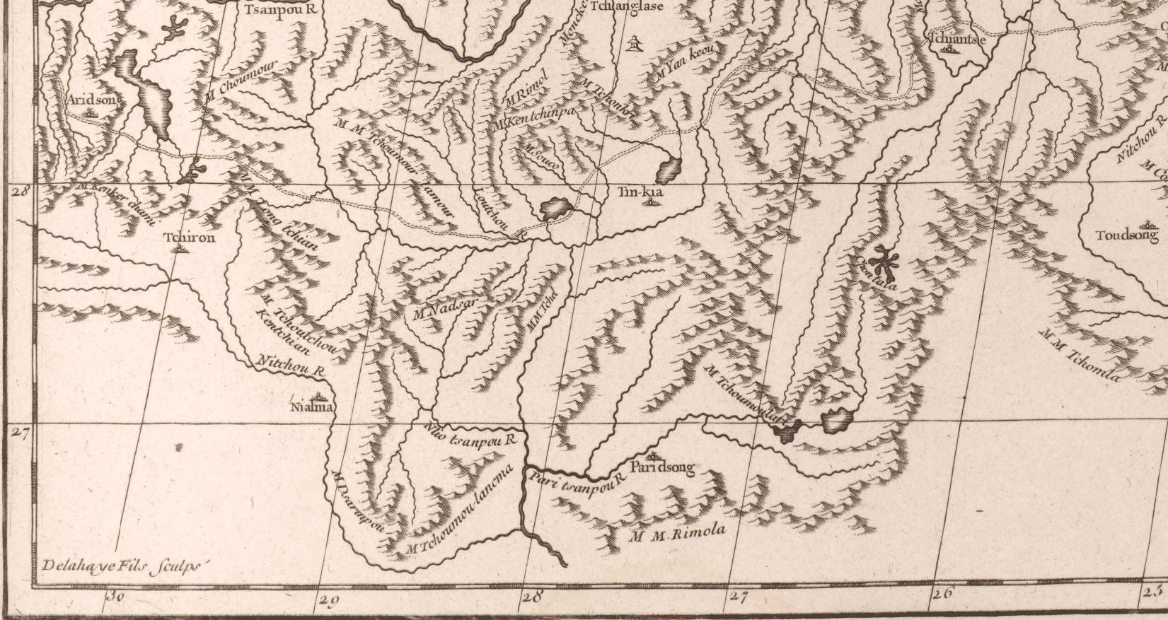
The result, completed in 1718, was the Kangxi (or K’ang-hsi) Atlas, a remarkable feat of early cartography. It’s quite a marvel, and became the defacto reference for future mapping of Asia, including Jean Baptiste Bourguignon D’Anville’s maps of the region produced in the 1730’s. Unlike the Kangxi Atlas - with placenames written in Chinese - D’Anville’s maps were transcribed, and his 1737 Carte generale du Tibet ou Bout-tan (General Map of Tibet and Bhutan) shows - west of Paridsong (Phari Dzong) and south of Tinkia (Tingri) - a mountain group called Tchoumour-lancma. This group is seen again in another map, du Tibet, et qui contient les pays des environs du Tsanpou (Tibet, and the areas around Tsanpou [Tsangpo]), this time labeled as Tchoumou-lancma.
To those of you familiar with Mount Everest and its alternate names, Tchoumou-lancma may sound familiar, quite similar to the Sherpa and Tibetan name for the mountain, Chomolungma (meaning “Goddess Mother of the World”), and even the Limbu appellation, Chajamlungma. Look closely at D’Anville’s maps, and you’ll see the placement of Tchoumou-lancma lines up fairly closely with Everest: not precisely, of course, but in reference to other identifiable places - Nialma (Nyalam), Tinkia (Old Tingri, or Shekar Dzong), Lasa (Lhasa), Tchiantse (Gyantse), etc. Keeping in mind that D’Anville was working from the maps of the Jesuits, who in turn worked from notes and information gathered by untrained lamas and locals sent to map these “unknown” territories, and the resulting maps are pretty spectacular.
You may be rightly asking: So, what of it all? Interesting, but what’s the point?
Well, the point is about names, naming, and what information those names convey…and what they leave behind.

1856 - the year Chomolungma became Everest - was the height of European colonial reductionism. Across the globe, blank spots on the map were being frantically filled in, places named and routes recorded in ever-increasing detail. As Robert MacFarlane writes in Mountains of the Mind:
The nineteenth century, more than any other, saw the wild places of the world being franked and hallmarked…it was during the 1800s that the micro-naming properly began. Niches, notches, shoulders, cols, ridges, glaciers, routes: all began to bear the names of climbers and explorers.
- Robert Macfarlane, Mountains of the Mind: Adventures in Reaching the Summit
To be fair, many mountains in the Himalaya retained their historic, indigenous names, but many across the globe did not: Denali was renamed McKinley (reverted in 2015); Tumanguya became Mount Whitney; Tahoma transformed into Rainier; Blue Sky Mountain to Mount Evans, Bear Lodge to Devil’s Tower, and more.
Sir George Everest was a firm believer that mountains should retain their local, indigenous names. But, when Waugh confirmed Sikdar’s calculations of Peak XV, perhaps the temptation to place an indelible Imperial mark was just too great. Waugh and his team argued that no local name could be found or identified. (As Nepal and Tibet were essentially off-limits to outsiders at that time, there was some logic to their argument.) However, as Sven Hedin pointed out in 1926 - and we discussed above - there was ample evidence more than a century prior to Sikdar’s measurements and Waugh’s naming that Peak XV had a local name. In 1921, the permit issued to the Reconnaissance Expedition by the 13th Dalai Lama in Lhasa referenced the peak to be climbed and explored as Chha-mo-lung-ma, and members of the ‘21 expedition were told by locals the mountain was Tshomo Lungma. The pilgrims’ guide book given to the 1936 expedition by the Abbot of Rongbuk stated the name was Chomo-langma, and General Bruce - an old Himalaya hand - wrote in 1909 that the Sherpa he knew well called the mountain Chomolungma. Nonetheless, Waugh and his successors stuck with Everest - as has the world for 150+ years. (The Chinese government has long advocated for a name change, decreeing as early as 1952 - after their occupation of Tibet - that the peak would now be known as Chomolungma.)
Within all this naming discussion, though, there is a shred of an argument for Waugh’s decision (whether he knew it or not): The Jesuit maps, and D’Anville’s versions, and indeed in local parlance, Chomolungma refers not to that little patch of snow atop the mountain, the summit, but rather to the massif as a whole. As T.S. Blakeney pointed out in 1965, to Tibetans, Sherpa, and others, “it is the mountain in its entirety that matters, as one sees with the most sacred of all Hindu-cum-Buddhist mountains, Kailas.”
As I’ve argued here before (and here, and here), the summit is but one part of the massif, of the mountain, of the adventure, and to my mind a part of much lesser significance than the mountain as a whole, the adventure in total. The real point of climbing is not so much the summit, but the journey, the path, and the things we learn, we face, we overcome, along the way. As Greg Child said:
Somewhere between the bottom of the climb and the summit is the answer to the mystery why we climb.
- Greg Child

The mystery why we climb. Isn’t that what it’s all about in the first place? Isn’t that why we climb - to taste, however briefly, the divine thrill of the unknown, to step for a spell into the great questions of life, reducing our existence to the merest fundamentals? The summit is a token; the answers lie veiled in the ether, hidden in the mists and snows and labyrinths of that somewhere between the bottom and the top, the beginning and the end. The mystery, the answer, the point of the whole enterprise…it isn’t found atop Everest, it doesn’t lie in the summit snows, there is no epiphany to be had when that final footfall is made.
The mystery isn’t on Mount Everest, it’s within Chomolungma.


Keep writting on,,,nice one
Thanks, and I'll do my best!
Jake, I first read this post on the same day I was lucky enough to meet and chat with you (at the Boulder Explorer's Club prior to your presentation). Have now reread it -- carefully -- several times since. As I told you then and there, it's a remarkably accurate and lucid and gracefully-written essay. So I'll put it down to synchronicity or serendipity or maybe just a little bit of Khumbu Karma that you happened to post it just prior to our encounter. Looking forward to more.
Hi Scott, thanks for the note and the kind words! It was such a pleasure to meet you at the EC event in Boulder, and thanks for all your work on climate and more! Hope you're well, and looking forward to connecting again in future.
GREETINGS, JAKE, ET AL.:
Grateful for both your excellent historiography and for the forum in which to respond, I take this opportunity to make a more lengthy reply in segue to a matter that I hope will become as important among the general mountaineering community as it is to me. That matter is the prospect of the medical regeneration of lost limbs --which no doubt seems like a total non sequitur in the context of naming a mountain, but bear with me here through some introductory remarks.
To supplement your research, I would first point out that the mountain was never named ‘Ever-est’ --which is probably the most mispronounced name in the English language-- but rather ‘Eve-rest’ (pronounced ‘eev rest’) as Sir George himself always insisted. This sort of confusion is in fact affirmed by the original author of your title ‘What’s in a name’ --none other than that most famous of English authors, William Shakespeare (who troubled some over his own name).
Getting back to the Himalaya (or ‘Himal-ya), the name ‘Ever-est’ is in one sense quite appropriate, as can be drawn from an experimental result obtained by the Xtreme Everest research group (see video): [https://www.xtreme-everest.co.uk/What-is-Hypoxia] The severe loss of mental acumen, common to novice climbers, is due to precipitous decline in atmospheric pressure at high altitude, whose consequence is a gentle and unexpected loss of consciousness, and untimely death, on the slopes of the mountain “where”, as the pun goes, “they shall Ever Rest”.
And this is the medical issue which segues back into limb regeneration: Research into this possibility has yielded extraordinary results, pioneered in large part by one Dr. Robert Becker, who earnestly sought the answer to a fundamental biological conundrum --why do some animals, such as salamanders, naturally regrow amputated legs, while other animals, such as frogs, do not? Briefly, Dr. Becker discovered that an organism’s body will deal with a traumatic wound in one of two ways: it will ‘heal’ the wound by sealing off the wound area from blood loss and contamination with protective scar tissue, or it will REGROW the lost body part from neighboring related cells. After intensive research, Becker found a subtle difference in electrical potential in the respective wound areas of frogs and salamanders --which measured positive for frogs and negative for salamanders. When Dr. Becker induced a negative potential on a frog’s wound area, the frog --hang on-- THE FROG REGREW ITS LEG! [https://www.washingtonpost.com/archive/opinions/1978/08/06/growing-new-limbs/7dd8603d-6e64-4727-8d1b-47dfa8162478/] Needless to say, this has enormous significance for limb regrowth in higher animals --humans included. Becker’s research has been continued by a number of scientists seeking to regrow lost limbs, notably one Dr. Michael Levin of Tufts University [https://news.harvard.edu/gazette/story/2019/07/wyss-researchers-has-electrifying-insights-into-how-bodies-form/]
[https://humanlimbregeneration.com/how-can-humans-regenerate-body-parts-with-bioelectricity/]
Why bring all this up in the context of mountaineering?
One of the most common injuries among mountaineers is loss of digits (fingers and toes) due to frostbite. And here we have a strong potential subject base for a laboratory of digit regrowth --a relatively low-risk and low-cost experimental opportunity in which to perfect the means for whole limb regrowth.
Although frostbite wounds may be considered a mark of distinction among some, would not most mountaineers really like their toes and fingers back? I believe the risks and costs of such a venture would be low owing to the simple nature and limited extent of the injury --meaning that any mishap in the process could more easily be corrected and restarted, or at worst resumed after reamputation of the digit-- and to the relative ease of regrowing digits. Do not doubt this latter claim: the spontaneous regrowth of the last joint of the fingers of young children is already well documented in the medical literature! [https://www.theseekerbooks.com/articles/electric.htm]
and,
[https://www.youtube.com/watch?v=jwlbP_cpFb4]
Progress in prosthetic limb design might be commendable, but would not actual regrowth of the original limb be utterly spectacular? With the right nutrition and growth environment, the cell’s innate capacity to regrow can be stimulated if the proper information is supplied: one basically only needs to inform the cells to grow anew rather than merely scar over lost limbs. Think of all the tragic injuries and amputations that afflict many of our fellows, from war wounds to traffic accidents, from genetic defects to toxic chemicals (think thalidomide) which result in the severe birth defects of missing or malformed limbs. How much relief, instead of lifelong grief, could be granted to those so bodily disenfranchised?
[https://www.youtube.com/watch?v=jwlbP_cpFb4]
I encourage the wider outdoor community to take these sentiments to heart, and promote in any way possible the prospect of natural limb regeneration among the medical community. I cannot help but believe that a Nobel prize, or a series of Nobel prizes, awaits those medical pioneers who make successive progress in the extent and viability of limb regrowth --having first accomplished ‘proof of concept’ on the formerly frost-bitten digits of some willing and intrepid high-altitude mountaineers.
Hi Stewart,
Thanks, as always, for your insightful comment. I was not aware of the research and developments done on the regrowing of limbs - fascinating! I've been fortunate enough to retain all of my fingers and toes during my mountain adventures, but know quite a few who have not. I'm guessing it is late in the game for them to have a hope of regrowing tissue, but this research seems promising for others. I hope it one day comes to fruition!
[…] For years, the logic seemed simple: fast. Go fast, minimize your time in the Icefall. Don’t dawdle, don’t fuss, just move, move, move, and get through it all. So, for two expeditions and over a dozen trips through the mayhem, that’s precisely what I did, moving quickly, efficiently, even stealthily, as if I could somehow sneak through without the mountain even knowing I was there, a gnawing gnat on the forearm of Sagarmatha. […]