There's been a lot of chatter recently about the story of Mallory and Irvine and the mystery surrounding their disappearance on June 8, 1924. Much of the recent discussion has been sparked by the recent revelation by Mark Synnott that Chinese climbers may have found - and removed - Andrew Irvine's remains from the mountain back in 1975.

This news is huge for the mountaineering community, as it's highly likely that the only proof of whether or not Mallory and Irvine reached the summit 98 years ago would have been with Irvine, contained in the Kodak Vestpocket camera the duo carried with them. If Irvine is gone, the camera likely is as well, and with it any definitive proof of a summit or not.
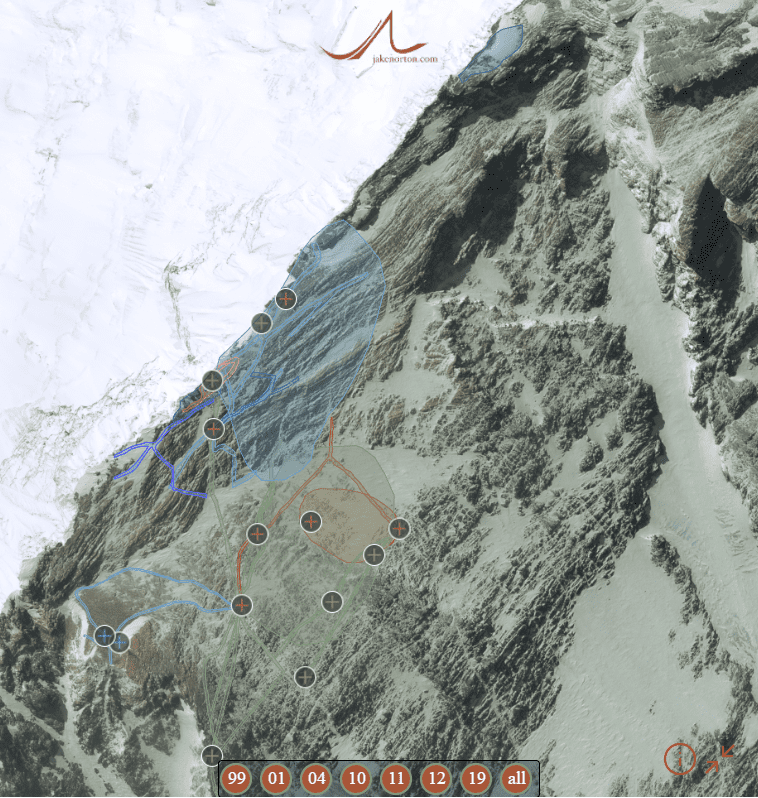
There is a lot more to tell on this story, but I'll save that for another post soon. In the meantime, I decided to put together a comprehensive, interactive map of all the searches and findings related to Mallory & Irvine and the pre-World War II and pre-modern era Everest expeditions on the north (Tibetan) side.
It took a while, and I by no means purport this data is 100% complete or 100% accurate. But, it's a start, and hopefully a good resource for all those interested in the history and mystery of Mount Everest.
Please take a look at it below, explore, and let me know what I've missed, where I've made mistakes, and what else needs to be added. And, for those of you who want to go deeper, please head on over to the unDefined Community where there's a ton of discussion on Everest 1924 and the pre-War era.


Hi Jake, do you have a location for the 1933 ice axe find site?
Hi Chris,
Thanks for your note, and great to hear from you! I hope you are doing well!
I didn't put in the ax location from '33, but probably should. I've never had a good, concrete location for it, but will put it in nonetheless as it's important data. I think I should also add in the general idea of where Odell reported seeing them, as well as his possible location when he made the sighting.
Let me know what else you think I should add!
Thanks, and best,
Jake
Great work 👍🏻 Do you know if anyone has plans to explore the Norton Route in search of evidence of whether Mallory and Irvine took this route instead of the ridge?
Thanks, Alex. I don't know of anyone planning to search the Norton route. The challenge with that is the Chinese now do not like anyone doing anything "extra-curricular" on the mountain, and keep a pretty tight leash on all climbers up there, so searching off-route would require either (a) permission, which is difficult to obtain, or (b) doing it in secret, which is nearly impossible on Everest these days.
Jake was there ever a search along the fall line of Mallory for a possible location of where he fell from?
Hi Michael, Yes, to some degree. The general fall line below the steep parts of the Yellow Band were searched in 1999 and 2001, and again in bits in 2004. In the steep YB, I can't say a precise fall line was searched, as the terrain doesn't really allow for that, but a lot of the possible fall line areas have been searched over the years. Hope this makes sense!
Nice work on your interactive map of Everest and its climbing mysteries and history. This has doubtless been noted many times in the past (though I have not seen it); I'm wondering if (1) a scale and orientation (particularly a fine scale) could be superimposed over your interactive map and (2) if the major structures of the Everest topography could be identified. The lower sections are of significant size (the icefall, etc) and thus readily identifiable but locating the principal components of the portions above 8,000 meters (as the mountain gets smaller and smaller) are not so easy. Very difficult to know the first step from the second, which direction you are traveling, and how far apart they are (100 meters, 1,000 meters...)? If there is another annotated reference I haven't found, I'd love to know of it, otherwise I'm hoping you can help.
Hi Lee,
Thanks for the comment and suggestions. I will work to make it a bit more comprehensible, as I know it can be quite confusing to say the least. I have added another view of the mountain with all the findings over the years, one which should be a bit more logical as it's the "standard" view from the North. But, I'll work to better it as much as possible!
Hi Jake, even though I‘m not Chris I would love to have the two locations -or an idea of them - added!
And thanks a lot for that great overview.
All the best
Gudrun
Hi Gudrun, thanks for your comment, and I'll work to add those. I did add a more head on view with all the findings, but will add those two locations as well as best I can. Thanks!
Hi Jake, some researchers (https://thewire.in/history/mallory-irvine-second-step-everest) have suggested the terrain below and to the right of the third step ("Olga's" boulders) as a possible site of interest! It's speculative of course, but the idea, as I'm sure you know, is that Irvine might have waited for Mallory somewhere around there, resting in a sleeping bag, and/or that they might have possibly dumped oxygen as well as other things (tins etc.) in that region.
Do you know if anyone has looked at this site as of yet, or how challenging that would be? It seems like a place where you could veer of course and have a look without anyone really noticing it! If something was found there it would basically prove that one or both summited.
Hi Jon,
Thanks for the comment! Yes, Phil and Ajay's writeup has a lot of merit, and the boulders near the Third Step - as well as all the terrain above the Second Step - have long been important search areas I think. We sent a search team to that area in 2019 - David Morton, Adrian Ballinger, and cameraman John Griber - but they did not find anything. That said, with the little time they had, coupled with the rough weather and crowding on the route, they were not able to search as thoroughly as I would've hoped. I think that area is still one of high interest, and where it is likely M&I might have dropped O2 or some other evidence of their passing. Like you said, finding any evidence putting them above the Second Step would be ground breaking, and prove almost beyond a shadow of doubt that they reached the top in '24. Maybe one day the Chinese will reopen the North Side and allow for some more searching...but I'm not going to hold my breath!
Why do you think Mallory didn’t have a oxygen rack on his back when he fell?
Thanks, Warren. Hard to say for sure. We don't know definitively that he didn't have one on. He might have, but it got torn off as he fell. The other possibility is that they ran out of O2 earlier on, and jettisoned the frames to save weight and energy. If that is the case, there could still be something critical to find high on the mountain.
Odell is said to have gone out to search for Mallory and Irvine the next morning IIRC. How close do you reckon he got to where Mallory lay? It doesn't look that far on your on map from Camp IV.
Thanks for the note, David, and sorry for the delayed reply. I've been traveling. Anyway, yes, Odell did go out looking a bit from Camp VI on the North Ridge. My recollection is he headed more upward toward the NE Shoulder and NE Ridge, so would not have been going in the direction of Mallory's body so much. But, had he gone that way (SSW) across the North Face, it would have taken maybe an hour or so one way to get to Mallory's resting place.
Thanks Jake for all your search on everest for Mallory and Irvine.
I am sure that finding Mallory body as produce lot of emotion for you and all the group over there.
The only who know if they reach the summit is Mallory and Irvine and it is fine like that.
Thanks, Rejean, for your comment and thoughts. Indeed, it is fine to not know what happened on June 8, 1924 - perhaps in a way more enjoyable to have be a forever mystery!
Jake do you think that some expedition will be organized on everest north ridge for the 100e anniversary of the mystery?
I'm not sure, Rejean. I would hope so, and would imagine someone will try to at least poke around, but I don't know of any official searches being planned for the spring.
Hi Jake,
Thabk you for your amazing work. Drones have been proven to be able to be used around and above Everest. Could they be a help in searching? I have read somewhere about them being used?
Greetings from Portugal
Hi Carlos,
Thanks for your note, and great thought for sure on drones. They definitely can be flown up there (well, can physically be flown, not always legally), and we used one a bit in 2019 as did the National Geographic team. We didn't fly above Camp VI as we didn't have permission to do so, but NG did, although sadly it seems that footage has not/will not be released. Would be great to see those images and footage.
All that said, I think they could be a huge help in searching up high, and getting into the nooks and crannies that are hard to visit in person. The added challenge is, of course, needing to have a day to fly and shoot when the snowpack is minimal and the winds favorable - not always an easy ask on Everest!
Thanks again, and greetings back at you from Colorado!
This might sound stupid but what if Irvine stayed on the ridge and went down towards the 3
Pinnacles. I’m not an expert but Irvine wasn’t the best climber and Maybe he couldn’t keep up with Mallory and missed the turn. And if he was descending in the dark then he could have easily missed it. Plus they were one of the first expeditions and there wasn’t any fixed ropes. This is just a random thought and I’ve not looked into it.
Jake, thank you for the work that you have done in this mystery! While I have never been there and only know from what I have seen in video and photos has there been much thought of Irvine potentially falling off the ridge on the East side and if so has any searching been done over there?
Hi Chad, thanks for your note and thoughts. Yes, I think there is certainly a chance Irvine could have fallen down the Kangshung Face as others have done since. No one to my knowledge has specifically searched down there, and so very few have been on the face there's not many that could report. I remember a whisper years back of some bit of flotsam found by one of the teams at the base, but I don't think it amounted to anything. And, sadly, that side gets so pulverized by icefall and avalanche my hunch is that anything down there would be well buried and gone by now.
Hi Jake, thanks so much for all your work on this mystery. Its fascinating, and a real wormhole to fall into when I should be working at the moment! A thought struck me, that I haven't seen asked elsewhere, and thought it would be a good idea to ask someone who knows the route well!
Taking the scenario where Mallory falls and the rope breaks leaving Irvine stranded on or near the ridge, what are the chances of Irvine getting lost and missing the exit cracks and continuing in the direction of the pinnacles where he succumbs to the cold? Its just I cant recall ever seeing a discussion in relation to searching for him in that rarely visited part of the mountain. Apologies if the suggestion is a bit silly, its just I can't visualise what that area near the exit cracks is like when actually there, and if its feasible for an inexperienced climber like Irvine to get lost there in the dark when trying to come off the ridge
Many thanks
Sean
Thanks, Sean - glad you've enjoyed the bits I've shared! It's always a pleasure to put out what I can and try to add to the knowledge base however possible.
As for your theory, it's entirely plausible, and I think quite likely! That's along the lines of what I've long thought, that Irvine (if we believe the sightings by Xu Jing and Chhiring Dorje) survived the fall that killed Mallory, and tried to get back to Camp VI, but got disoriented and lost along the Ridge, eventually finding some nook to rest in where he could shelter from the wind and possibly survive the night. In fact, getting lost up there is very possible - not so much these days when the route is fixed with a constant line - but it did happen at least twice that I know of, to Brent Okita on May 21, 1991, and to Dave Hahn on May 19, 1994. Both spent the night out on the Ridge below the First Step after having trouble locating the Exit Cracks and gullies leading down through the Yellow Band. So, not hard at all to imagine Irvine getting in trouble in the same area - it's devious terrain!
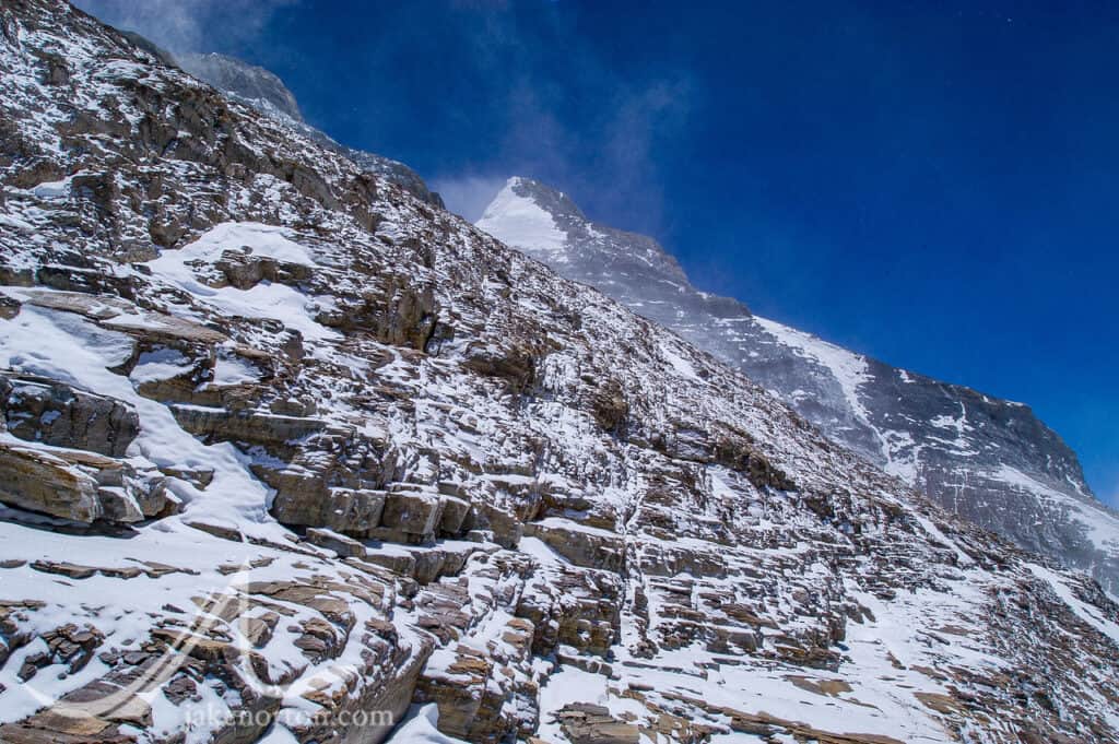
On searching north/northeast of the Exit Cracks, we did that somewhat in 2019, and Jochen's team did as well in 2010 and 2011. From what I saw in person, it is quite possible Irvine could have moved to the Warts and perhaps a bit beyond while disoriented, but I can't imagine him (or anyone) going much beyond that without knowing they were way off route as the Ridge gets very nasty along there, steeper and more rugged. If you look at this photo from 2019, you can see the terrain I'm talking about on the Ridge to the right of the panorama.

Hope this all makes sense, Sean, and thanks again!
Hi, I cant get enough of this mystery and I LOVE all the work and effort all people have done.
Im a webb-developer (10+ years) and would love to help out with this project.
Worked a lot with interactive maps and similar projects. Feel free to contact me! One approach I would like to see is adding a "wikipedia" style where more people easily can contribute with info, ideas etc, as filters of course.
Another is the ability to add pictures taken from different locations, preferably by accurate GPS-geolocation data from the picture itself.
Some general questions I have..
1) What is on the other side of the ridge?
It is hard to find info about it.. it is just a white area. What would happen if Irvine fell or was "flipped" over the edge? Where would he end up and why would it be hard to find remains there?
2) What is below Mallorys remains?
Mallorys location is known, could Irvine remains be located below Mallorys location?
Great work Jake, well done and thank you.
I'll have a guess and say Mallory and Irvine turned around where the oxygen bottle was found due to realising time and the weather was against them and possibly having had a mishap/injury. They descended below the ice axe (anchoring off it?) and took a fall/slip at the top of the snow field above Mallory's final resting place. Odell's sighting of the pair was a red herring to secure future funding or else he was just mistaken, maybe?
We'll never really know but it's an enduring and fascinating mystery. Absolutely gripping stuff!
1924 Camp VI says mornal route, probably meant normalroute.
Ha, obviously did not run spell check! Thanks, Gary - I'll put it in the to-do list!