As the weather warms up and we start thinking about getting out into the hills for fun adventures, a recent commentator on my post from back in 2010, when I was doing some writing for Vail Resorts, noted that my post from my hike-bike adventure from Grizzly to Lenawee was no longer active. It was a really fun 1/2-day trip, and one worth sharing again. So, since it’s gone from Vail’s website, here it is again for those interested. Enjoy!
I don’t like people.
Wait, let me rephrase that…Often, when I’m going off into the mountains, I prefer to have some solace, some time to myself to think via the sweat and strain of the peaks. And, despite how often one hears about the hordes of people in the Colorado backcountry, it’s still pretty easy to get out, get away, and have a fun adventure.
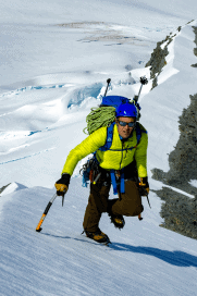
Last Friday, I started off with a cup of coffee at 4:00 AM, and not much else. I knew I had about 8 hours to kill, that I wanted to push hard, and be, well, alone. As the morning coffee sparked my brain, I remembered the neat ridge I saw on a trail run a few weeks earlier off Loveland Pass. It looked from a distance like a mini-Ellingwood Ridge, spires and towers jutting from a long ridgeline connecting Grizzly Peak (13,427 feet) to Lenawee Mountain (13,204 feet) and on to the top of Arapahoe Basin ski area. Could be a fun outing, I thought, and at the last moment decided to throw in my road bike to complete the trip in a nice fashion.
By 5:45 AM, I was on top of Loveland Pass, excited about the stunning, bluebird morning shaping up. I drove down the other side to the base of A Basin, and stashed my road bike in some trees near the highway. Back up the pass by car, I was parked and ready to walk at 6:15.
From the top of Loveland Pass, the route to Grizzly Peak is well traveled, well defined, and simple. (The website for the Colorado Thirteeners has a great route description. At 7:30, I was on top of Grizzly and ready to explore the ridge to Lenawee.
From Grizzly, the ridge drops obviously south-southeast, and runs for about 1.5 miles to the 13,204 foot summit of Lenawee. While intimidating from this vantage point, it turns out to be nothing but fun scrambling with amazing views and exciting exposure. To keep it as interesting as possible, I stuck to the prow of the ridge almost all the time, creating a difficulty of about 5.2 on a couple of short sections. That said, short drops from the ridge crest onto the peak’s western flanks would easily keep the traverse in Fourth Class terrain.
After gaining the first, prominent point on the ridge (circa 13,000 feet), the hardest parts of the route are over, and fun 3rd and 4th class scrambles roll up and down over towers and across saddles to the summit of Lenawee. I made it there by 8:50 AM, and found the summit register under a pile of stones. As expected, this is not a popular peak: according to the “guest book”, only 8 people, including me, had climbed it in 2010.
Since it was still early, I decided to abandon my plan to descend from Lenawee’s summit down a long, arching ridge to the ski area below and instead continue following the ridge to the top of A Basin. Again, this section looks a bit intimidating, but proves otherwise once en route. More 3rd and 4th class scrambling west-southwest led for a mile or so to the top of the ski area. From here, an easy descent along the trails led me back to the highway and to my bike…which fortunately was still there.
It was now 10:40 on what was forecasted to be the hottest day of the summer so far, and it was definitely heating up even in the high country. The thought of riding my road bike with a 25 pound pack up the short-but-steep road to Loveland Pass was less than enticing, but unavoidable. A quick change in the woods took me from hiker to biker, and in 20 minutes I was back at the car.
According to my phone’s GPS, the day was a total of 17 miles, car to car, and took just over 5 hours. What it couldn’t know, though, was that en route I encountered only 2 other people, and none after the summit of Grizzly. My only companions there were a couple of mountain goats, a white-tailed ptarmigan, beautiful views, and a lot of fun.
Just as it should be.
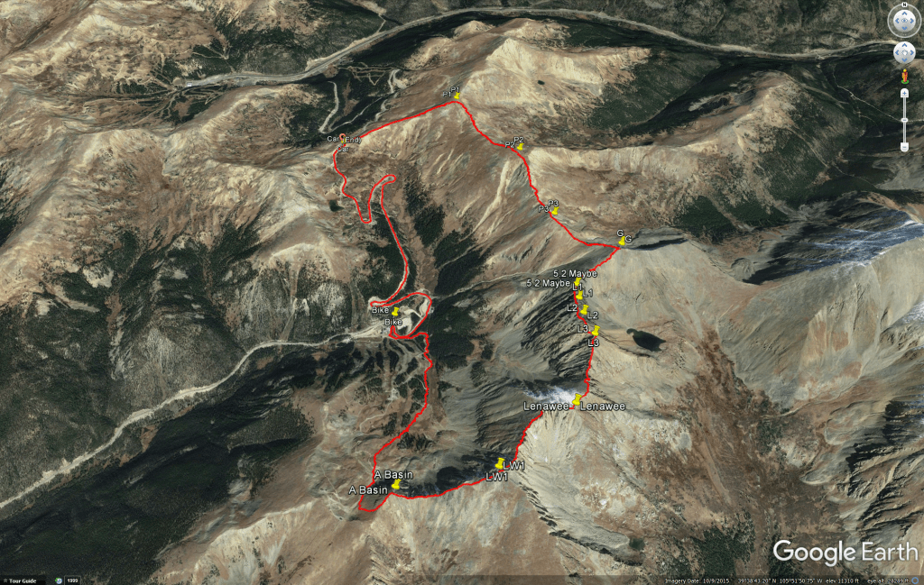
Download a kml of the adventure here.

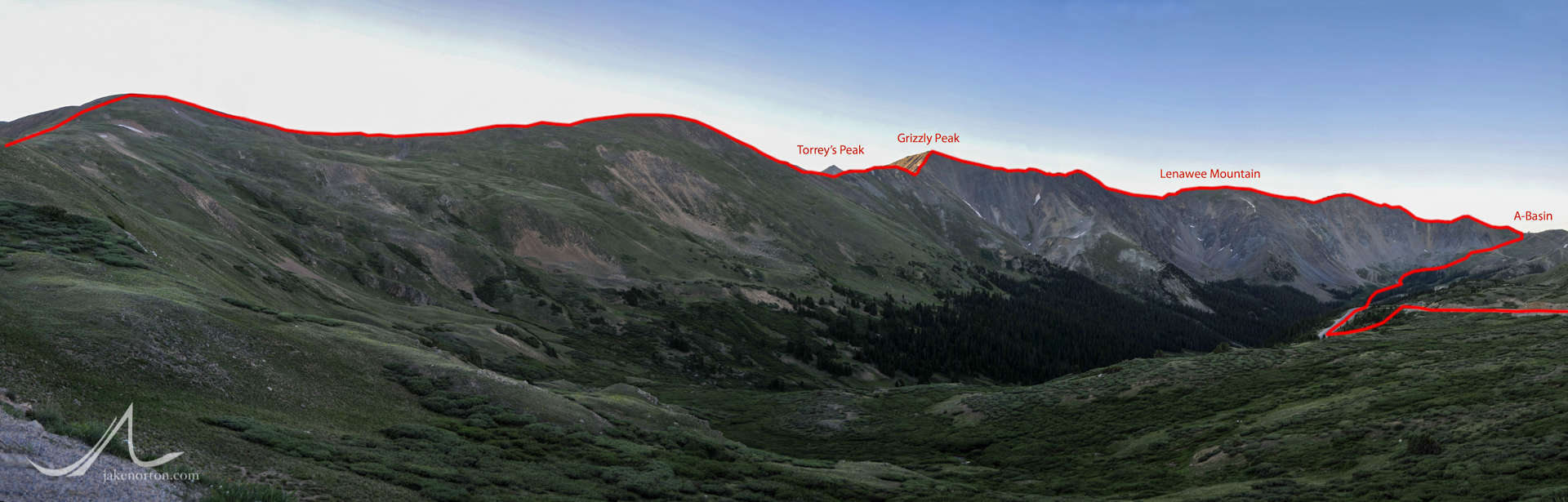
The route from Loveland Pass to Grizzly Peak, on to Lenawee Mountain, and finally back to Arapahoe Basin ski area. 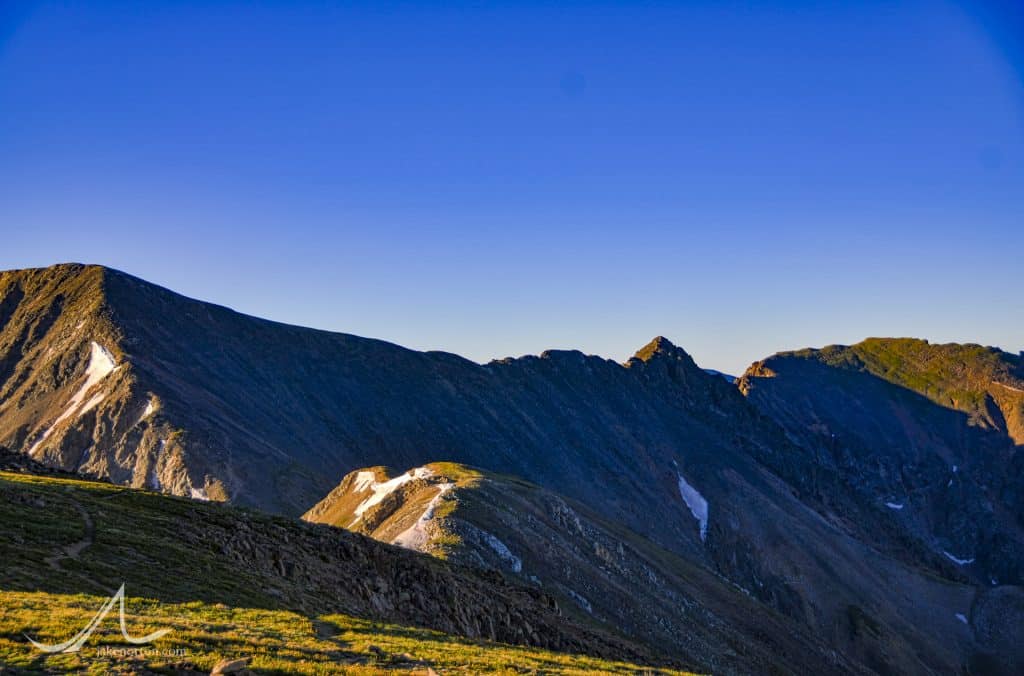
View from “Cupid” to Grizzly Peak and on to Lenawee Mountain. 
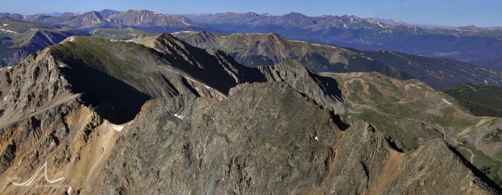
The ridge connecting Grizzly Peak (13,427 feet) to Lenawee Mountain (13,204 feet) and on to Arapahoe Basin ski area, from the summit of Grizzly Peak. 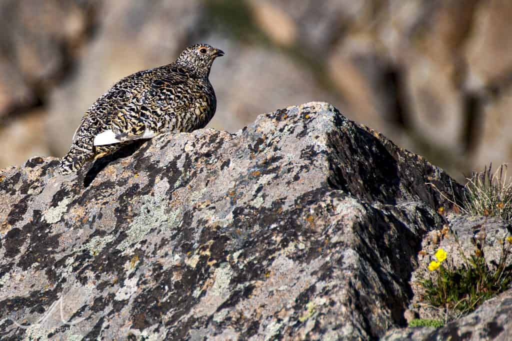
A female white-tailed ptarmigan (Lagopus leucura) on top of Lenawee Mountain (13,204 feet) near Loveland Pass, Colorado.